
British Columbia Highway Webcams: Real-Time Road Safety
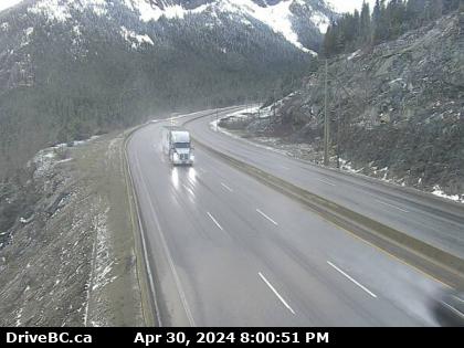
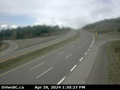
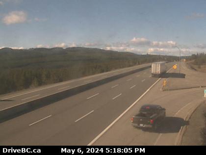
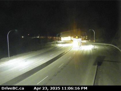
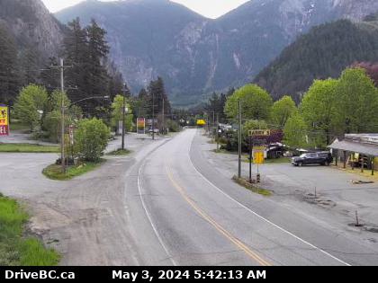
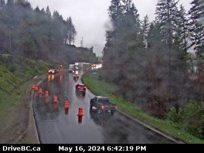
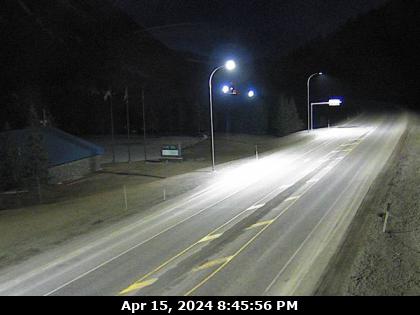
British Columbia highway webcams help drivers stay informed. These cameras show live road conditions, traffic flow, and weather updates. Furthermore, travelers can check them before heading out. Highway 5 British Columbia being one of the most popular routes can be viewed through these cameras.
One major benefit is safety. By viewing road conditions, drivers can avoid accidents. Slippery roads, fog, or heavy traffic become easier to plan for. This reduces risks and keeps travel smoother.
Another advantage is time-saving. Commuters can check for delays and choose the best route. No one likes getting stuck in traffic. Webcams help people avoid congestion and reach their destination faster.
Tourists also benefit. They can see scenic routes before starting their journey. Whether driving through the mountains or along the coast, webcams offer a preview of the road ahead.
In short, British Columbia Road Cameras make travel safer and easier. Checking them before a trip can save time and prevent trouble. Plan ahead, drive smart, and stay safe!
Highway 5 British Columbia The Coquihalla and Beyond
British Columbia Highway 5 is one of the province’s most significant roadways. Commonly called the Coquihalla Highway in the south and the Southern Yellowhead Highway in the north, it stretches 524 kilometers, connecting Hope to Tête Jaune Cache. This highway plays a crucial role in BC’s transportation system, linking Vancouver to Alberta and serving as a major trade and travel route.
Route Overview
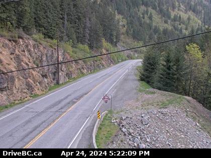
The highway begins in Hope, where it intersects with Highway 1 (Trans-Canada Highway). From there, it heads north, cutting through the rugged Cascade Mountains. Between Hope and Kamloops, Highway 5 is a four- to six-lane freeway, with a speed limit of 120 km/h—one of the fastest highways in BC.
Beyond Kamloops, the highway narrows to two lanes and follows the North Thompson River until it reaches its northern terminus at Tête Jaune Cache, where it meets Highway 16 (Yellowhead Highway).
Hope to Merritt: The Coquihalla Highway
This section is the most well-known part of Highway 5. Built in the 1980s, the Coquihalla was designed to shorten the travel time between Vancouver and the interior.
Notable Landmarks
- Great Bear Snowshed – Located 35 km north of Hope, this tunnel-like structure helps protect vehicles from avalanches.
- Coquihalla Summit – The highest point on the highway at 1,244 meters (4,081 feet) above sea level.
- Falls Lake Recreation Area – A scenic stop with hiking trails and a stunning alpine lake.
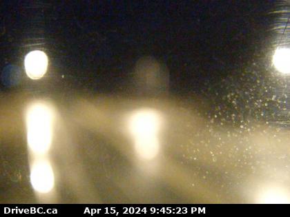
The Coquihalla section is known for steep grades, sharp curves, and challenging winter conditions. Snowfall can be heavy, and sudden weather changes are common.
Merritt to Kamloops: The Southern Interior
As the highway descends into Merritt, the landscape changes from mountain terrain to rolling hills and ranchlands. Merritt, known as the “Country Music Capital of Canada,” serves as a key junction where Highway 5, Highway 8, and Highway 97C meet.
Points of Interest
- Nicola Valley – A region rich in ranching history and Indigenous culture.
- Quilchena – Home to the historic Quilchena Hotel, built in 1908.
- Stump Lake – A popular fishing spot known for its crystal-clear waters.
As the highway approaches Kamloops, travelers will see vast grasslands and the confluence of the North and South Thompson Rivers. Kamloops is a major urban center and an important stop along Highway 5.
Kamloops to Tête Jaune Cache: The Yellowhead Route
After Kamloops, Highway 5 follows the North Thompson River for 93 kilometers to Little Fort. From there, it continues north through Clearwater, Blue River, and Valemount before reaching its endpoint at Tête Jaune Cache.
Scenic Highlights
- Wells Gray Provincial Park (near Clearwater) – A paradise for outdoor lovers, featuring Helmcken Falls, wildlife viewing, and hiking trails.
- Blue River – A small community known for heli-skiing and grizzly bear tours.
- Mount Robson Provincial Park (near Tête Jaune Cache) – Home to Mount Robson, the highest peak in the Canadian Rockies.
This northern section of Highway 5 is less traveled but offers breathtaking views of forests, mountains, and rivers.
History of Coquihalla Highway
Origins and Construction
The southern portion of Highway 5 follows the route of the Kettle Valley Railway, which operated between 1912 and 1958. When BC needed a faster connection between the coast and the interior, the government chose this path to build the Coquihalla Highway.
The Coquihalla was completed in 1986, reducing travel time between Vancouver and Kamloops by nearly 90 minutes. Initially, it was a toll highway, but tolls were removed in 2008 after public pressure.
Expansion and Improvements
In recent years, BC has invested in upgrading Highway 5. Projects include:
- Widening sections of the Coquihalla to handle more traffic.
- Improving avalanche control measures to enhance safety.
- Adding electric vehicle charging stations along the route.
Despite these improvements, winter closures due to heavy snow and accidents remain common.
Importance of Highway 5
Economic Impact
Highway 5 is a key trade corridor, supporting industries such as:
- Forestry – Trucks transport lumber and raw materials daily.
- Tourism – The highway provides access to ski resorts, parks, and outdoor attractions.
- Agriculture – Farmers and ranchers use the route to ship goods to markets.
Travel and Connectivity
The highway serves as the shortest land route between Vancouver and Edmonton, making it vital for business and leisure travelers. It also connects remote communities to larger cities.
Challenges and Hazards
While Highway 5 is a crucial roadway, it has some risks:
- Winter Weather – The Coquihalla is notorious for snowstorms, icy roads, and low visibility.
- Steep Grades – Sections of the highway have long, steep descents, requiring careful driving.
- Traffic and Accidents – Due to its high speed limits, the Coquihalla sees frequent crashes, especially in winter.
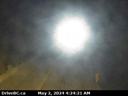
Travelers should check BC highway webcams and weather forecasts before using this route.
British Columbia Highway 5 is more than just a road—it’s a lifeline connecting the coast to the interior. From the high-speed Coquihalla to the scenic Yellowhead, this highway offers travelers stunning landscapes, historic sites, and essential transportation links.
Whether driving for business, tourism, or adventure, Highway 5 remains one of BC’s most important and well-traveled routes.
The History of British Columbia Highways
British Columbia (BC) has a vast network of highways that connect cities, regions, and neighboring provinces. These roads also provide key links to the United States. The province’s highway system follows a structured numbering pattern, first introduced in March 1940. Some highways align with U.S. Numbered Highways, making cross-border travel smoother.
Highway 1, part of the Trans-Canada Highway, is the province’s most well-known route. It stretches across Canada and follows a standardized numbering system. However, BC’s roads have a long and fascinating history, beginning with ancient Indigenous trails and evolving into modern highways.
Early Travel in British Columbia
Before highways existed, travel in British Columbia was difficult and dangerous. People had to navigate through thick forests, scale rocky cliffs, and cross towering mountains. Early travelers endured harsh weather, isolation, and rugged landscapes to reach goldfields, trade centers, and fertile lands.
First Nations Trails: The Foundation of BC’s Roads
For thousands of years, Indigenous peoples lived and traveled across BC. They built an extensive network of trails to connect communities, hunt, and trade. These paths were the earliest roads in the province. Many later became the foundation for modern highways.
Indigenous peoples built wooden bridges, stairways, and other structures to overcome natural barriers. One of the most impressive examples was the Hagwilget Bridge over the Bulkley River near Hazelton. This wooden bridge, reinforced with telegraph wire, connected communities and was used for nearly 50 years.
Fur Trade Routes and Exploration (1805–1850s)
The fur trade brought new travelers to BC. Traders from the Hudson’s Bay Company and the North West Company used brigade trails to transport furs and supplies. Some trails followed Indigenous paths, while others were newly carved through forests and mountains.
Waterways also played a key role. Canoes and boats transported goods, but on land, traders cleared rough paths. These early trails were the beginning of BC’s road system.
The Impact of the Gold Rush (1850s–1860s)
The discovery of gold in BC changed everything. Thousands of prospectors arrived, creating a demand for better roads. Governor James Douglas saw the need for transportation routes to support the gold industry and maintain British control over the region.
The Famous Cariboo Wagon Road (1862–1865)
One of BC’s most famous early roads was the Cariboo Wagon Road. Built between 1862 and 1865, it connected Yale to Barkerville, a booming gold mining town. The road was 5.5 meters (18 feet) wide, allowing wagons to pass each other.
Construction was extremely challenging. Workers had to blast through cliffs, build wooden trestles, and navigate steep terrain. Despite the difficulties, the Cariboo Wagon Road became a vital route for miners, settlers, and traders.
The Expansion of Wagon Roads (1870s–1890s)
After the gold rush, the government shifted its focus to building roads for agriculture and settlement. New roads connected farming regions, such as the Fraser Valley and the Okanagan.
Notable projects included:
- North Road (New Westminster to Port Moody)
- Hope to Skagit Road (intended for gold miners but later abandoned)
- Cache Creek to Savona Road (provided access to the Columbia River goldfields)
These roads helped BC develop its economy beyond mining. However, road construction was slow and expensive, making travel difficult in many areas.
Railways and Their Effect on Road Development (1880s–1920s)
The construction of the Canadian Pacific Railway (CPR) in the 1880s shifted focus away from roads. Many freight routes now relied on rail transport, leading to a decline in road expansion.
Rail construction also destroyed portions of the Cariboo Wagon Road, especially in the Fraser Canyon. As a result, some roads fell into disrepair until new investments in the 1920s.
The Rise of the Automobile and Early Highways (1920s–1930s)
By the 1920s, automobiles were becoming popular. More people wanted to travel by car, but BC’s road system was inadequate. At this time, BC had around 28,000 registered vehicles. By 1930, the number had grown to nearly 100,000.
The First Modern Highways
To support car travel, the government paved major roads and improved routes. However, many highways remained unpaved, rough, and narrow.
Key developments included:
- The Pacific Highway (linked Vancouver to the U.S. border)
- The Cariboo Highway (rebuilt and modernized)
- The Island Highway (connected Victoria to Campbell River)
Despite these improvements, BC still lacked a province-wide highway system.
World War II and Highway Expansion (1939–1945)
During World War II, highway development slowed. Resources were focused on the war effort, and little paving was done. However, the government recognized the need for better transportation infrastructure after the war.
The Boom in Highway Construction (1950s–1960s)
After the war, BC experienced rapid economic growth. More people owned cars, and industries like forestry, mining, and tourism relied on highways. The government launched massive road-building projects.
The Trans-Canada Highway (1950s–1962)
One of the most significant projects was the Trans-Canada Highway (Highway 1). This national highway connected BC to the rest of Canada, running from Vancouver through the Rocky Mountains.
Key features of this project included:
- Widening and paving major roads
- Building new bridges and tunnels (e.g., Port Mann Bridge, Fraser River Tunnel)
- Expanding access to remote areas
The Coquihalla Highway, completed in the 1980s, later provided an alternative high-speed route.
Urban and Multi-Lane Highways
By the 1950s, BC’s urban centers faced growing traffic congestion. To ease traffic, the government built:
- Highway 99 (Vancouver to the U.S. border)
- Highway 97 (connected the interior of BC)
- The Lougheed Highway (an alternative to Highway 1)
Multi-lane highways became common, especially around Vancouver and Victoria. These expansions helped commuters, businesses, and tourists travel more efficiently.
The Modern Era: Highways in the 21st Century
Today, BC’s highways continue to evolve. New infrastructure projects improve safety, reduce congestion, and support economic growth.
Key Recent Projects
- Sea-to-Sky Highway Upgrade (2003–2010): Upgraded for the 2010 Winter Olympics
- Port Mann Bridge Replacement (2012): One of the widest bridges in the world
- Highway 1 Improvements: Ongoing widening and expansion projects
The province also focuses on environmentally friendly transportation, including electric vehicle charging stations and public transit integration.
British Columbia’s highway system has come a long way from Indigenous trails and gold rush wagon roads. From the Cariboo Wagon Road to the Trans-Canada Highway, roads have shaped the province’s growth and development.
Today, BC’s highways connect people, industries, and communities. As technology and transportation continue to advance, these roads will remain vital to the province’s future.