


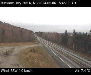

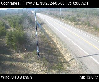


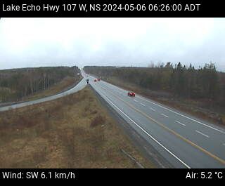


Nova Scotia Highway Cams
Nova Scotia is known for its stunning coastal landscapes and charming towns. The province’s highways and roads wind through some of the most beautiful areas in Canada. In fact, these routes not only connect different regions but also offer breathtaking views of the Atlantic Ocean, forests, and rolling hills. Furthermore, Nova Scotia Highway Cams are placed all along these roads, helping you stay informed about road conditions in real-time. Nova Scotia Road Cameras are a cheat code on navigating this beautiful province.
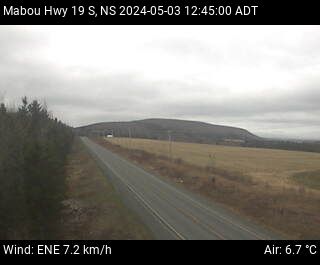
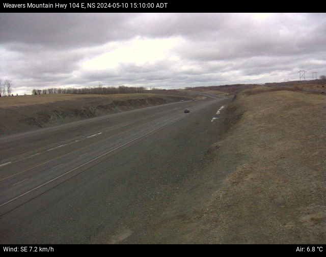
Highway 104: The Trans-Canada Route
Highway 104 is part of the Trans-Canada Highway system. It stretches across Nova Scotia, linking the New Brunswick border to Cape Breton. This highway is the main route to the island of Cape Breton, famous for its rugged coastlines and the Cabot Trail. As you drive along Highway 104, Nova Scotia Highway Cams keep you updated on traffic and weather. These cameras ensure you can plan your trip safely.
The Cabot Trail: A Must-See Drive
The Cabot Trail is one of the world’s most famous scenic drives. This 298-kilometer loop circles Cape Breton Island, offering stunning views of the Gulf of St. Lawrence and the Atlantic Ocean. The trail passes through Cape Breton Highlands National Park, where you can hike, see wildlife, and take photos. Nova Scotia Highway Webcams are placed along the Cabot Trail. These cameras let you check road conditions before you begin your adventure, making your journey smoother and safer.
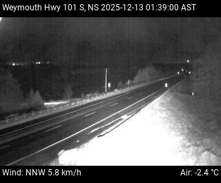
Highway 101: Through the Annapolis Valley
Highway 101 takes you through the Annapolis Valley, known for its apple orchards, vineyards, and historic towns. This highway offers a peaceful drive through rolling farmland and charming towns like Wolfville and Annapolis Royal. Live Cameras are along Highway 101 help you monitor traffic and weather. This makes it easier to plan stops at wineries, farm markets, and historic sites along the way.
Highway 103: Coastal Beauty on the South Shore
Highway 103 is the perfect route for exploring Nova Scotia’s South Shore. This highway runs along the coastline, offering spectacular views of the Atlantic Ocean. It passes through fishing villages like Lunenburg, a UNESCO World Heritage site. The road also leads to Peggy’s Cove, famous for its iconic lighthouse. Nova Scotia Road Cameras along Highway 103 provide real-time updates. These cameras help you navigate this scenic route safely while enjoying the beautiful coastal views.
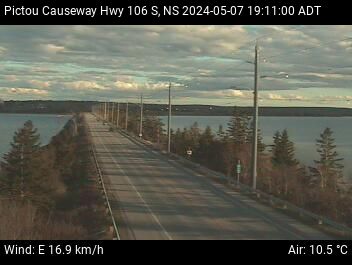
Highway 102: Connecting to Halifax
Highway 102 connects Halifax, Nova Scotia’s capital, with the rest of the province. Running from Halifax to Truro, this highway is an important route for both locals and visitors. The Live camera updates make it easier to plan your journey into the city or toward quieter areas in northern Nova Scotia.
The Evangeline Trail: Nova Scotia Highway Cams
The Evangeline Trail follows Highway 1 and takes you through the heart of Nova Scotia’s Acadian region. This route is named after the heroine of Henry Wadsworth Longfellow’s famous poem. It offers a glimpse into Nova Scotia’s rich cultural history. Nova Scotia Highway Cams along the Evangeline Trail keep you informed about road conditions. This ensures your trip is both enjoyable and safe.
Nova Scotia Highway Cams: Plan Your Trip
Nova Scotia’s highways and roads offer more than just transportation. They provide access to some of the most scenic and culturally rich areas in Canada. Whether you’re driving the Trans-Canada Highway, exploring the Cabot Trail, or visiting the Annapolis Valley, Nova Scotia Highway Cams are essential tools. These cameras, placed throughout the province, help you monitor traffic and weather. As you plan your road trip through Nova Scotia, use the Nova Scotia Highway Cams to ensure a safe and enjoyable journey.
The History of Nova Scotia Highways
Nova Scotia’s highway system plays a key role in connecting communities, supporting trade, and driving tourism. Over the years, the province has worked hard to build and improve its road network. From early gravel roads to modern expressways, the highway system has come a long way.
Early History of Nova Scotia Highways
The First Roads in Nova Scotia
In the early days, Nova Scotia relied on trails used by the Mi’kmaq people. These paths helped indigenous communities travel across the land. When European settlers arrived, they used these same routes. Over time, settlers built rough roads using logs and stones.
The Rise of Stagecoach Roads
By the 1800s, stagecoach travel became common. Roads connecting Halifax to other towns improved. The government started maintaining key routes. However, these roads were still rough and hard to travel on, especially in bad weather.
The Railway Era Slows Road Development
During the late 1800s and early 1900s, railway expansion took priority. Many people relied on trains for long-distance travel. As a result, roads remained in poor condition. Only local roads saw improvements during this time.
Highway Development in the 20th Century
The Introduction of Automobiles
Cars became popular in the early 1900s. People needed better roads for safer travel. In response, the government started paving major routes. By the 1920s, Nova Scotia had its first paved roads.
The Trans-Canada Highway Project
The 1950s marked a major shift in highway development. Canada launched the Trans-Canada Highway project. This project aimed to connect all provinces with a modern road system. Nova Scotia played a key role by building Highway 104, linking the province to New Brunswick.
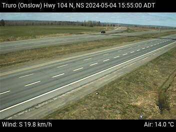
Expansion of the 100-Series Highways
During the 1960s and 1970s, the province expanded its highway network. The 100-series highways were introduced to improve traffic flow. These roads provided faster connections between cities and rural areas.
These highways help move goods, services, and people efficiently.
Twinning and Safety Improvements
In recent years, Nova Scotia has focused on twinning highways. This means adding extra lanes to improve safety. Twinning helps reduce traffic congestion and lowers the risk of head-on collisions. Highway 104, for example, has seen significant twinning projects.
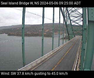
Bridge and Tunnel Infrastructure
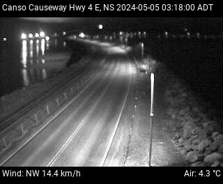
Bridges and tunnels are key parts of the highway system. The Canso Causeway, built in 1955, connects mainland Nova Scotia to Cape Breton Island. Other major bridges, like the Macdonald and MacKay bridges, link Halifax and Dartmouth. These structures support heavy traffic daily.
Future of Nova Scotia’s Highways
Sustainable Road Projects
The government is investing in greener road solutions. Efforts include using recycled materials in construction and adding electric vehicle charging stations along highways.
Smart Highway Technology
Nova Scotia is exploring smart highway technology. Future plans include digital road signs, real-time traffic updates, and improved lighting systems. These changes will make driving safer and more efficient.
Continued Expansion and Maintenance
Ongoing highway maintenance ensures roads stay in good condition. The province continues to expand and improve highways to meet growing demand.
Nova Scotia’s highway system has evolved from simple dirt paths to a modern, well-maintained network. Investments in safety, expansion, and technology will keep improving road travel for years to come. Whether you’re commuting or exploring, the province’s highways help keep Nova Scotia moving.
Absolutely! Here’s a 1000-word section focused on Nova Scotia History, beginning with the Indigenous peoples and moving through early European settlements, written in clear, engaging, and active language using transition phrases and simple sentence structure.
The Deep Roots of Nova Scotia History
Nova Scotia’s story stretches far beyond colonial times. Before any European ship touched its shores, this land was already full of life, history, and culture. The original custodians of the region were the Mi’kmaq people. They are part of the larger Algonquian-speaking family and have lived in Nova Scotia for thousands of years.
The Land of the Mi’kmaq
The Mi’kmaq called their homeland Mi’kma’ki (also spelled Mi’gama’gi). This vast territory spanned present-day Nova Scotia, Prince Edward Island, parts of New Brunswick, Newfoundland, the Gaspé Peninsula, and even parts of Maine. Life for the Mi’kmaq was deeply tied to the land and water. They hunted, fished, and followed the seasons across their territory.
Their culture was rich and vibrant. Communities were close-knit, and knowledge passed down through oral traditions. According to older records, some Mi’kmaq believed they had arrived from the west and came into conflict with an earlier group known as the Kwēdĕchk. This conflict reportedly lasted for many years and ended with the Mi’kmaq becoming the dominant group in the region. This marked a new chapter in Mi’kma’ki, one that would last until European contact.
First European Arrivals
In 1497, John Cabot sailed along the eastern coast of Canada, likely passing Nova Scotia. But it wasn’t until the early 1600s that Europeans began settling. The French were the first to attempt settlement. In 1604, they arrived in the Annapolis Basin, but chose to set up camp on Saint Croix Island, now part of Maine. Harsh winters forced them to abandon it.
The next year, in 1605, they returned and built Port Royal in present-day Annapolis Royal. This was the first permanent European settlement in Canada. It became the heart of what they called Acadia. Importantly, this new settlement was built in Kespukwitk, a district within Mi’kma’ki. For the next 150 years, Acadians and the Mi’kmaq would live, trade, and interact across the region.
The Scottish Claim: New Scotland
While the French were building Acadia, the British had their eyes on the region too. In 1621, King James VI of Scotland granted a charter to Sir William Alexander. This gave him permission to found a colony called New Scotland—or “Nova Scotia” in Latin. In 1629, about seventy Scots arrived to claim this land.
However, the Scottish colony was short-lived. Just three years later, in 1632, the French retook the territory. The Scottish settlers were forced to return home. Even so, the name “Nova Scotia” remained, and over time it became the official name of the province.
A Century of War and Struggle
From the late 1600s through the 1700s, Nova Scotia became a battleground. The French, British, Mi’kmaq, Dutch, and even American privateers clashed here. Forts, settlements, and entire communities were pulled into repeated cycles of war. Nine major battles occurred in the early years alone. Port Royal changed hands multiple times.
Queen Anne’s War, which lasted from 1702 to 1713, saw the British take control of Port Royal in 1710. They renamed it Annapolis Royal in honor of Queen Anne. The Treaty of Utrecht in 1713 made British control official—at least on paper. In reality, the area remained largely Acadian and Mi’kmaq.
Even after 1713, peace was rare. The Mi’kmaq, often with French support, resisted British expansion. Father Rale’s War (1722–1725) saw the Mi’kmaq sign treaties of submission, but conflict persisted. Another war, Father Le Loutre’s War, began in 1749 when the British founded Halifax, a fortified town built without Mi’kmaq consent. Tensions exploded again.
The Acadian Expulsion
The most heartbreaking moment in Nova Scotia’s early history came during the French and Indian War (1754–1763), part of the larger Seven Years’ War. The British, fearing that Acadians might support France, decided to remove them. Between 1755 and 1764, over 10,000 Acadians were deported. Families were split. Homes were burned. Entire communities vanished.
The British then invited New England Planters to settle the now-empty lands. After the war, some Acadians returned, but their numbers and communities were never the same.
Loyalist Arrivals and African Heritage
The American Revolution (1775–1783) brought another major shift. Nova Scotia stayed loyal to Britain. By the end of the war, thousands of United Empire Loyalists fled north. Around 33,000 Loyalists arrived in Nova Scotia, including about 3,000 Black Loyalists. Many of them settled in Shelburne and founded Birchtown, the largest free Black community in North America at the time.
These new settlers brought capital, skills, and fresh energy. However, their arrival also created tensions. Land became scarcer. The Mi’kmaq and Acadians were pushed to the margins. Despite being promised equal treatment, many Black Loyalists faced racism, poor land, and broken promises.
Birth of New Communities
The late 1700s saw the birth of many communities across Nova Scotia. Shelburne briefly became one of the largest British towns in North America. Meanwhile, the British split Nova Scotia into smaller provinces. In 1784, Cape Breton and New Brunswick became separate colonies. Despite these changes, Halifax remained a military stronghold and economic center.
Looking Ahead
By the turn of the 19th century, Nova Scotia was a mix of cultures. The Mi’kmaq, Acadians, British, Scots, African Nova Scotians, and others all shaped the province. The region’s identity was forged through cooperation, conflict, and constant change.
Certainly! Let’s pick up right where we left off, continuing the story of Nova Scotia’s remarkable history through the 19th century and beyond.
A New Century: Nova Scotia in the 1800s
As the 1800s began, Nova Scotia entered a new era. The region was no longer simply a battleground for empires. It was beginning to chart its own course. Trade, shipbuilding, and politics became the driving forces shaping the province.
The War of 1812 and Nova Scotia’s Role
The War of 1812 between the United States and Britain had a direct impact on Nova Scotia. Although no major battles were fought on Nova Scotia’s soil, the province played a critical role. Communities funded and built privateer ships—private vessels armed to attack enemy ships. These ships captured American vessels and brought prizes back to Halifax.
One of the most dramatic events of the war was the battle between HMS Shannon and the American frigate USS Chesapeake. After a fierce fight, the British captured the American ship and sailed it into Halifax Harbour in 1813. The event was celebrated across the province and is remembered as a moment of pride.
Political Reforms and Responsible Government
After the war, Nova Scotia turned inward. Citizens began pushing for more say in how they were governed. For years, the British-appointed governors held most of the power. But a local leader named Joseph Howe believed in democracy and fought for it.
Through newspapers, speeches, and organizing, Howe rallied people to the cause. His efforts paid off. In 1848, Nova Scotia became the first colony in the British Empire to win responsible government. That meant the people, through elected officials, could finally make decisions about their future.
Industrial Growth and Maritime Strength
During the 1800s, Nova Scotia’s economy grew quickly. Its ports bustled with activity. Timber, coal, and fish were shipped out by the ton. At the same time, shipbuilding became a massive industry. Wooden sailing ships, known as schooners and brigs, were built along the coast.
Nova Scotians became known worldwide for their skill in building and sailing ships. Shipbuilders like Donald McKay and William Dawson Lawrence earned international fame. By the mid-1800s, the province owned more wooden ships per capita than almost anywhere else in the world.
One of the greatest achievements of the time came in 1895, when Joshua Slocum, a Nova Scotian sailor, became the first person to sail solo around the globe. His journey inspired sailors everywhere.
The American Civil War and Nova Scotia’s Economy
When the American Civil War broke out in 1861, Nova Scotia remained neutral, like the rest of British North America. However, this neutrality didn’t stop trade. Halifax continued shipping goods to both the North and the South.
This trade helped Nova Scotia’s economy boom. Ports grew busier, and local merchants got rich. Still, some Nova Scotians volunteered to fight, mostly joining the Union side.
Joining Canada: A Controversial Choice
In the 1860s, a debate swept across the colonies: should they unite to form one country? In Nova Scotia, this sparked fierce disagreement. Charles Tupper, the Premier at the time, supported joining Confederation. He believed it would bring economic benefits and stronger defense.
However, Joseph Howe and many others strongly opposed the idea. They feared that Nova Scotia’s unique identity and voice would be lost. Despite this, Nova Scotia officially joined Canadian Confederation on July 1, 1867, alongside New Brunswick and the Province of Canada (now Ontario and Quebec).
The backlash was swift. In the first election after Confederation, anti-Confederation candidates won nearly every seat. Still, over time, the province adjusted to its new role within Canada.
Cultural Icons and Global Recognition
The Bluenose and Maritime Legacy
In the early 20th century, Nova Scotia’s seafaring reputation soared thanks to one ship: the Bluenose. Built in Lunenburg in 1921, this fishing and racing schooner became a symbol of speed and skill. The Bluenose won numerous races and earned a place on the Canadian dime—a legacy that lasts to this day.
The Halifax Explosion
A dark moment in the province’s history occurred on December 6, 1917. A French cargo ship loaded with explosives collided with another ship in Halifax Harbour. The result was the Halifax Explosion—the largest human made explosion prior to the atomic bomb. It killed nearly 2,000 people, injured thousands more, and flattened much of the city.
The disaster drew international aid and showed the world the resilience of Nova Scotians. Communities quickly came together to rebuild. The tragedy remains one of the defining events in the province’s story.
Modern Nova Scotia and Ongoing Legacy
Today, Nova Scotia continues to honor its past while shaping its future. The Mi’kmaq are gaining recognition for their traditional rights and continue to play an important role in the province. Communities celebrate Acadian culture, Black Loyalist heritage, and the influence of Scottish and Irish settlers.
From its Indigenous roots to its colonial struggles, from shipbuilding fame to political reform, Nova Scotia’s history is rich, complex, and deeply human. Every region—from Cape Breton to Annapolis Royal—tells part of this ongoing story.
Frequently Asked Questions (FAQs)
1. Who were the first people to live in Nova Scotia?
The Mi’kmaq were the first known inhabitants of Nova Scotia. They have lived in the region for thousands of years and continue to have a vibrant culture today.
2. What was the first European settlement in Nova Scotia?
The first permanent European settlement was Port Royal, established by the French in 1605.
3. Why were the Acadians expelled from Nova Scotia?
The British expelled the Acadians between 1755 and 1764 during the French and Indian War because they feared they would support the French in the conflict.
4. How did Nova Scotia join Canada?
Nova Scotia joined Canada on July 1, 1867, through Canadian Confederation, although the move was initially unpopular in the province.
5. What role did Nova Scotia play in the War of 1812?
Nova Scotia supplied privateer ships and supported British naval efforts during the war, particularly through its port in Halifax.
6. What was the Halifax Explosion?
In 1917, a collision between two ships in Halifax Harbour caused a massive explosion, killing nearly 2,000 people. It remains one of the deadliest non-nuclear explosions in history.