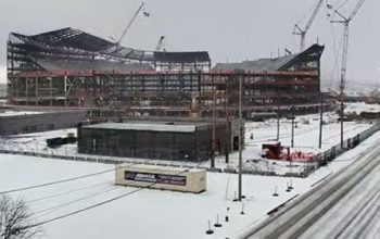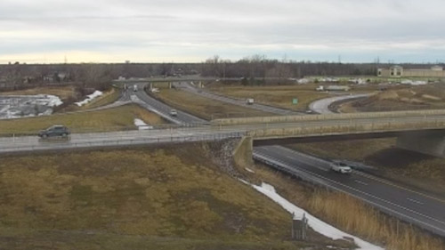
NYS Thruway Webcams: Check Live Traffic & Road Conditions
NYS Thruway webcams provide real-time views of this major toll highway. Stretching 570 miles, the Thruway connects key cities like New York City, Albany, Buffalo, and Syracuse. These live cameras help drivers stay informed about traffic, weather, and road conditions before hitting the road.
With a quick glance, you can see if roads are clear, wet, or snow-covered. This helps travelers plan better and avoid unexpected delays. The webcams update constantly, offering accurate, up-to-date views. Whether you’re commuting, taking a road trip, or just checking the weather, these cameras are a valuable tool.
The NYS Thruway is a vital link for commerce and daily travel. Knowing road conditions ahead of time can save you time and stress. Before you drive, check the webcams for a smoother, safer trip. Stay informed and travel smart with NYS Thruway live cameras!
The New York State Thruway: A Key Transportation Corridor
The New York State Thruway, officially named the Governor Thomas E. Dewey Thruway, is one of the most important highways in the United States. Stretching 569.83 miles, this controlled-access toll road connects major cities across New York. The New York State Thruway Authority (NYSTA) operates and maintains the system, ensuring smooth travel for millions of drivers each year.
This highway serves as a crucial link between New York City, Albany, Syracuse, Buffalo, and the Pennsylvania border. It also connects New York with neighboring states (Connecticut, Massachusetts, New Jersey, and Pennsylvania) and the Canadian province of Ontario. As one of the busiest toll roads in the country, the Thruway plays a major role in long-distance travel, commerce, and daily commuting.
History and Development
The idea for a tolled highway connecting New York’s major cities first emerged in 1949. At the time, growing traffic congestion and economic expansion made efficient roadways essential. Construction moved quickly, and the first section, between Lowell and Rochester, opened on June 24, 1954.
By 1955, the majority of the mainline was completed, allowing uninterrupted travel across the state. Over the next decade, several spurs and connectors were added to improve access to other highways, neighboring states, and Canada. In 1957, much of the Thruway system was incorporated into the Interstate Highway System, with sections designated as Interstates 87, 90, and 95.
Thruway System Overview
Today, the NYS Thruway system consists of six major highways, each serving a different region:
1. Mainline (I-87 & I-90) – The longest segment, stretching 496 miles from Yonkers (New York City area) to Ripley (Pennsylvania border).
2. Berkshire Connector – A short segment that links the Thruway to Massachusetts via I-90.
3. Garden State Parkway Connector – A small section in Rockland County connecting to New Jersey.
4. New England Thruway (I-95) – A key route for travelers heading toward Connecticut and Boston.
5. Niagara Thruway (I-190) – Provides access to Buffalo and Niagara Falls.
6. Cross Westchester Expressway (I-287) – Connects Westchester County to the rest of the Thruway system.
Each of these highways plays an essential role in moving people and goods across the state and beyond.
Traffic and Usage
The NYS Thruway is one of the busiest toll roads in the United States. According to the International Bridge, Tunnel and Turnpike Association, it ranks fifth in overall traffic volume.
This highway is essential for:
- Daily commuters traveling between cities.
- Long-distance travelers heading to Boston, Toronto, Montreal, and other destinations.
- Truckers and commercial vehicles transporting goods across the Northeast.
Traffic varies based on location. The busiest areas include the sections around New York City, Buffalo, and Albany, while rural areas experience lighter congestion.
Tolls and Cashless Payment System
For many years, the Thruway used a mix of ticket-based and barrier-based toll collection. However, from 2016 to 2018, the system transitioned to cashless, open-road tolling. Now, drivers pay electronically using E-ZPass or receive a bill in the mail.
How Tolling Works
- E-ZPass users get discounted rates and automatic billing.
- Non-E-ZPass users are charged via Toll by Mail, with invoices sent to the vehicle’s registered address.
- Out-of-state E-ZPass holders pay slightly higher rates than New York E-ZPass users.
Certain sections, including Buffalo, the Garden State Parkway Connector, and the Cross Westchester Expressway, remain toll-free.
Speed Limits and Safety
The speed limit on most of the Thruway is 65 mph, but some areas have lower limits:
- Buffalo, Westchester, and Rockland counties have a 55 mph speed limit.
- Construction zones and urban areas may have temporary reductions for safety.
The New York State Police patrol the Thruway, enforcing speed limits and responding to emergencies. Safety measures like traffic cameras, variable message signs, and weather monitoring systems help drivers stay informed
Interstate Connections and Major Exits
The Thruway connects to several major interstate highways, making it a key route for travelers in the Northeast:
- I-87 (North-South): Runs from New York City to Albany and beyond.
- I-90 (East-West): Extends across the entire state from Massachusetts to Pennsylvania.
- I-95 (New England Thruway): Connects New York to Connecticut and Boston.
- I-190 (Niagara Thruway): Provides access to Buffalo and Canada.
Key exits along the Thruway include:
- Exit 24 (Albany): Connects to I-87 North toward Montreal.
- Exit 45 (Rochester): Provides access to I-490 and downtown Rochester.
- Exit 50 (Buffalo): Links to I-290 and Buffalo suburbs.
- Exit 61 (Ripley): The westernmost exit before entering Pennsylvania.
These major interchanges make the Thruway a convenient route for both local and long-distance travel.
The Future of the Thruway
The NYS Thruway Authority continues to improve the highway through various projects, including:
- Road resurfacing and bridge replacements to maintain infrastructure.
- Expanded electric vehicle (EV) charging stations along the route.
- Smart highway technology to enhance traffic management and safety.
With ongoing upgrades, the Thruway remains a modern, efficient, and reliable transportation corridor.
The New York State Thruway is a vital part of the Northeast’s transportation network. Stretching nearly 570 miles, it connects major cities, supports commerce, and provides travelers with safe, efficient routes across the state.
With cashless tolling, real-time traffic monitoring, and constant improvements, the Thruway continues to serve millions of drivers every year. Whether commuting, road-tripping, or transporting goods, travelers can rely on this historic and essential highway.
Before hitting the road, check the NYS Thruway webcams, traffic reports, and toll rates to ensure a smooth trip. Safe travels on the New York State Thruway!
The History of the New York State Thruway
The New York State Thruway is one of the most important highways in the United States. It stretches nearly 570 miles across the state, connecting major cities and providing a vital route for commerce and travel. The Thruway was an ambitious project that changed transportation in New York. Its history is filled with innovation, challenges, and expansion.
The Idea of a Toll Superhighway (1949-1950)
In 1949, state officials recognized the need for a modern, high-speed highway that could connect New York’s major cities. Traffic was increasing, and the state’s existing roads were not designed for heavy use. A tolled highway, which could generate revenue for its own maintenance, seemed like the best solution.
In 1950, the New York State Legislature passed the Thruway Authority Act, creating the New York State Thruway Authority (NYSTA). This independent public corporation would build, operate, and maintain the highway. To fund construction, the Thruway Authority issued toll revenue bonds, ensuring the project would be self-sustaining through tolls, rents, and concessions.
The plan also called for a hybrid toll system. In urban areas, barrier tolls would be used, while in rural areas, a ticket-based system would charge drivers based on distance traveled.
Construction and Early Development (1954-1956)
Construction moved quickly, and the first section of the Thruway, a 115-mile stretch from Lowell to Rochester, opened on June 24, 1954.
By 1955, most of the 426-mile mainline between Buffalo and the Bronx was complete. The final segment, connecting Yonkers to the Bronx, opened on August 31, 1956. This marked the full completion of the Thruway’s original mainline.
The entire project cost $600 million, equivalent to $5.15 billion in 2023. The funding came from $972 million in bonds, worth about $8.35 billion in today’s dollars. At the time, the Thruway was the longest toll road in the world.
Expansion and Interstate Designation (1957-1960)
In 1957, the Thruway was extended 70 miles west from Buffalo to the Pennsylvania state line, running along Lake Erie. This completed the highway’s westward connection, making it even more valuable for long-distance travel.
During the same period, New York built several spurs to connect the Thruway to highways in neighboring states:
- Berkshire Connector (1959) – Linked the Thruway to the Massachusetts Turnpike.
- New England Thruway (1958) – Provided a route to Connecticut and Boston.
- Cross Westchester Expressway (1960) – Connected to Interstate 287 in Westchester County.
- Niagara Thruway (1959) – Allowed easy travel to Canada via Niagara Falls.
These expansions strengthened the Thruway’s role as a major interstate travel corridor. The highway also connected directly to New Jersey’s Garden State Parkway, linking travelers to the New Jersey Turnpike and beyond.
Integration into the Interstate Highway System (1957-1970)
The Thruway soon became part of the growing Interstate Highway System. On August 14, 1957, the Federal Highway Administration (FHWA) designated portions of the Thruway as:
- Interstate 90 (I-90) – From the Pennsylvania border to Albany.
- Interstate 87 (I-87) – From Albany south to Newburgh and from Elmsford to New York City.
- Interstate 95 (I-95) – Covering the New England Thruway.
- Interstate 190 (I-190) – Designation for the Niagara Thruway in Buffalo.
- Interstate 287 (I-287) – Assigned to the Cross Westchester Expressway.
By 1970, all sections of the Thruway had official interstate designations. This helped secure federal funding for future improvements.
Major Incidents and Improvements (1970s-1990s)
The Schoharie Creek Bridge Collapse (1987)
On April 5, 1987, tragedy struck when the Schoharie Creek Bridge collapsed after heavy rain caused scour damage at its foundation. Five vehicles, including a tractor-trailer, fell into the creek, killing ten people.
Engineers quickly designed a stronger replacement bridge, which opened on May 21, 1988. This disaster led to nationwide changes in bridge inspection and maintenance practices.
Toll System Changes and E-ZPass Introduction (1993-1998)
In August 1993, the Thruway became the first highway in the U.S. to introduce E-ZPass electronic toll collection. By 1998, every toll barrier and interchange on the Thruway accepted E-ZPass, making travel more efficient.
In 1997, the Spring Valley toll barrier eliminated its car toll, reducing congestion.
21st Century Upgrades and the Tappan Zee Bridge Replacement
The New Tappan Zee Bridge (2013-2018)
The original Tappan Zee Bridge, which connected Westchester and Rockland Counties, was built on a tight budget in the 1950s. Over the years, it carried far more traffic than it was designed for, leading to serious structural concerns.
In 2013, construction began on a modern replacement, officially named the Mario M. Cuomo Bridge. The first span opened on August 25, 2017, and the second span opened on September 11, 2018. The new bridge is one of the longest cable-stayed spans in the U.S.
The Switch to Cashless Tolling (2016-2020)
In 2016, the Thruway began transitioning to cashless tolling, replacing barrier tolls with overhead electronic toll gantries. By November 14, 2020, the entire Thruway had switched to 100% cashless toll collection, reducing traffic delays.
The Thruway Today and Future Plans
The New York State Thruway remains a key transportation corridor, handling over 250 million vehicles per year. Ongoing projects focus on:
- Road resurfacing and bridge repairs to extend the highway’s lifespan.
- Electric vehicle (EV) charging stations at service areas.
- Smart highway technology to improve traffic management and safety.
As New York moves toward sustainable transportation, the Thruway will continue evolving to meet the needs of the future.
The New York State Thruway has played a crucial role in shaping modern transportation in New York and the Northeast. Since its opening in 1954, it has provided a fast, reliable route for travelers, businesses, and commuters.
From its early toll system to becoming part of the Interstate Highway System, the Thruway has constantly adapted to meet new challenges. Major events like the Schoharie Creek Bridge collapse, the introduction of E-ZPass, and the construction of the Mario M. Cuomo Bridge highlight its dynamic history.
Today, the Thruway remains one of the most important highways in the United States. With continued investment in infrastructure, technology, and sustainability, it will remain a vital link for generations to come.